tenomtrack
Customized solutions for IoT applications and global tracking of objects
Which communication network we use
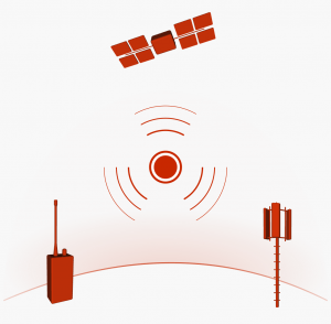
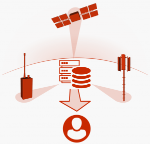
Our ultra-small trackers exchange data with radios on the ground and in space. The use of different communication systems enables regional, national and global coverage.
Private ground network
Our trackers communicate with our mobile and stationary radios. This enables local coverage with unique performance to receive data in real time, read the tracker memory and change the tracker settings.
Public ground network
Our trackers have excellent nationwide coverage as they can communicate with existing public low power communications networks in addition to our own radios.
Public satellite network
Satellites provide global coverage. We offer our customers a global tracking service with our small devices that can communicate with existing communication systems in space.
What makes our trackers special
The tracker is the core element of our system. It collects and stores position and sensor data. The tracker records the track with high accuracy, detects movements and collects information about the environment.
Each application has its own specific requirements. Our modular approach offers customized tracking devices. It allows the use of different sensors, access to a variety of measurement methods and unique functions.
Location
The most important information you get from the tracker is the location of the device. The location is given in geographical latitude and longitude (WGS84 reference system). The accuracy of the location depends on the environment. On average, it is in the order of a few meters.
Altitude
The altitude of the tracker is measured using signals from navigation satellites. It is given in metres above mean sea level. The accuracy of the measurement is slightly less than that of the location determination.
Speed
The current speed and the three-dimensional direction of the tracker’s movement is provided with each location determination.
Acceleration
Our trackers are equipped with a 3-axis accelerometer. The data of each axis are recorded for a few seconds at adjustable intervals and then stored. By comparing the data with reference values, conclusions about the behaviour can be drawn.
Shock
When a shock load occurs, the measurement of the intensity of the event is triggered. This makes it possible to determine the time and place of an event that could have caused damage to goods or objects.
Direction
The built-in magnetometer measures the alignment of the tag in relation to the earth’s magnetic field. Changes in the direction and strength of the magnetic field can be quantified at a fixed location.
Light
Measuring the intensity of ambient light gives an indication of the state of the current environment. Taking into account the local time, the tracker can determine whether it is indoors or outdoors.
Pressure
The pressure sensor measures the atmospheric pressure. Altitude changes or changes in ambient conditions can be determined with the data from the sensor. The pressure sensor is used to monitor controlled areas in industrial applications.
Humidity
The humidity of the environment is measured by a humidity sensor. The sensor enables the monitoring of a controlled area and can be used in context awareness applications.
Temperature
The built-in temperature sensor gives an indication of the current ambient temperature. It is a useful tool for industrial applications to monitor the environment and control compliance with specified conditions.
Memory
Our standard trackers are equipped with sufficient memory to store all recorded data. A data download can be initiated during contact with the communication network. Alternatively, the data can be read out via the service pins of the tracker.
LED
The LED indicates the status of the tracker. It can be used to locate and identify the tracker. The LED flashes according to a predefined schedule or is started by a command.
How we determine the location of the tracker
Global Satellite Navigation System (GNSS)
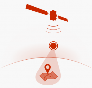
The best results for location determination are obtained when using a GNSS. Our trackers work with position and time data from GPS and GLONASS satellites. The tracker listens to the signals at regular intervals and stores the calculated location in the internal memory.
Ground radio location
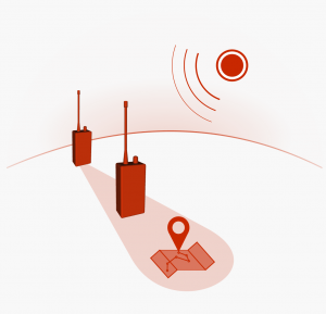
We offer our own location determination of the tracker for indoor applications or for applications that require extremely low power consumption. Our stationary radios receive the RF signals from the tracker and calculate its location. The accuracy of the measurement increases with the number of radios used.
How you get your data
We take care of the forwarding of all data from the tracker to the user, regardless of which communication network was selected. Our radio devices are operated via an app, which enables configuration parameters to be set on the trackers and data to be read out directly.

